Skip to content
The Ukrainian Heritage ProjectPreserving the history of Ukrainians beyond Ukraine.
ExploreCamps & HostelsMigrationDocumentsCommunity LifeSources
DOCUMENT · DENNY

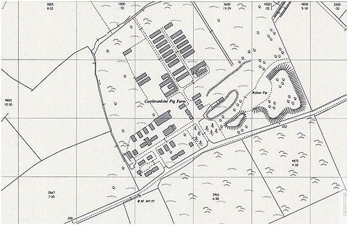
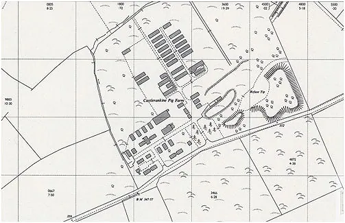
Castle Rankine on the 1963 Ordnance Survey map

1963Denny · United Kingdomhousing and buildings
Download
503 × 325
100%
Castle Rankine on the 1963 Ordnance Survey map, during agricultural reuse. Reproduced by G. B. Bailey, illustration 29, credited to National Library of Scotland.
ABOUT THIS ITEM

Castle Rankine on the 1963 Ordnance Survey map, during agricultural reuse. Reproduced by G. B. Bailey, illustration 29, credited to National Library of Scotland.

National Library of Scotland, reproduced by G. B. Bailey, POW Camp 64 (2022), illustration 29. No reuse licence stated.

Place
Castle Rankine