Victoria Park
Arrival and settlement
Peebles, Scotland · Public park from 1888; military camp photographed 28 March 1946; Ukrainian accommodation in the postwar years; cleared by 1988
Victoria Park in Peebles was a public recreation ground given over to a hutted military camp, and then to displaced Ukrainians who registered a branch of their national association there. The huts spread well beyond the present park into ground now covered by housing, and nothing of them was visible by 1988.
Introduction
Victoria Park in Peebles was both a wartime military camp and a place of accommodation for displaced Ukrainians after the war. Its huts occupied a larger area than the public park visible today, extending into ground later developed for housing. The park’s history brings together a Victorian civic gift, temporary military buildings and postwar resettlement.
A history in dates
- 1887Date inscribed on the surviving park gatepier.
- 1887The park is gifted to the people of Peebles by Sir John Hay of Haystoun and Kingsmeadows to mark Queen Victoria’s Golden Jubilee.
- 1888 and 1914The Burgh Council acquired land for the public park.
- 1923The burgh acquired ground at Springhill Road for tennis courts and a clubhouse.
- 1939–1945The army takes over the park and Nissen huts are built to accommodate troops.
- 28 March 1946RAF aerial photographs recorded the military camp, its Nissen huts and trench systems.
- Postwar yearsVictoria Park accommodated Ukrainians, who registered a branch of their national association there.
- 1959Further ground was added to the tennis courts and clubhouse.
- 1965Additional land was acquired to strengthen access from Springhill Road.
- By 1988The camp had been cleared and parts of its site redeveloped.
- 29 March 1995The park gates and railings were listed.
Sources for this section
- Historic Environment Scotland: Victoria Park gates and railings
- Victoria Park, Peebles: overview
- Scottish Borders Council: Peebles Common Good property
- Common Good Register, Peebles
- Peebles, Victoria Park: National Record of the Historic Environment 222941
- Peter Kormylo, Ukrainians in Scotland (2021)
- Kormylo on Father Babij’s daybook and the AUGB branches
- Historic Environment Scotland: Peebles, Victoria Park
A public park before the camp
The Burgh Council acquired the original park land in 1888 and 1914. The property titles dedicated it to public recreation for the people of Peebles. At Springhill Road, the surviving entrance has cream sandstone gatepiers, iron gates and railings. One pier carries the date 1887 and the other the initials VR. These structures belong to the park’s earlier civic history.
Recreation kept its foothold beside the camp. The burgh acquired ground for tennis courts and a clubhouse at Springhill Road in 1923 and added to it in 1959, so the sporting use brackets the camp years on either side. The main park is registered at Kingsmeadows Road and remains common good property, held for use only as a public park and recreation ground for the community of the burgh.
The Gazetteer for Scotland names the donor and the occasion. It records that the park was gifted to the people of Peebles by Sir John Hay of Haystoun and Kingsmeadows to mark the Golden Jubilee of Queen Victoria in 1887, and that Peebles Burgh Council acquired further land in three tranches, in 1914, 1923 and 1959. The gift date matches the year inscribed on the surviving gatepier, while the Common Good Register dates the council’s acquisition of the original park land to 1888.
Huts across the park
Historic Environment Scotland classifies the site simply as a twentieth century military camp, site number NT23NE 62, centred on NT 2550 3990 in the parish of Peebles. The camp was identified from RAF vertical air photographs 106G UK 1319, frames 5245 to 5247, flown on 28 March 1946. It consisted mainly of Nissen huts, some set within banks, with several trench systems visible at its south-eastern end.
The camp was larger than the park. The record notes that it extended south-east into what is now a housing estate and north-west onto the adjoining map sheet NT24SE. No operator, unit, capacity or dates are recorded, and the underlying photographs have not been inspected here, so the huts can be described but not counted or dated.
The Gazetteer for Scotland supplies the operator the archaeological record lacks. It states that during the Second World War the park was taken over by the army and Nissen huts were built to accommodate troops, and that these were cleared after the war with no trace remaining. It gives no dates for the takeover or the clearance, and no unit or capacity.
The camp and its changing landscape
| Place or feature | Documented relationship |
|---|---|
| Victoria Park | Core of the military camp; later public recreation |
| South-eastern area | Nissen huts and trench systems visible in 1946 |
| Cleland Avenue and Victoria Park Drive | Later housing on parts of the camp site |
| Springhill Road entrance | Earlier sandstone gates and railings dated 1887 |
Ukrainian accommodation
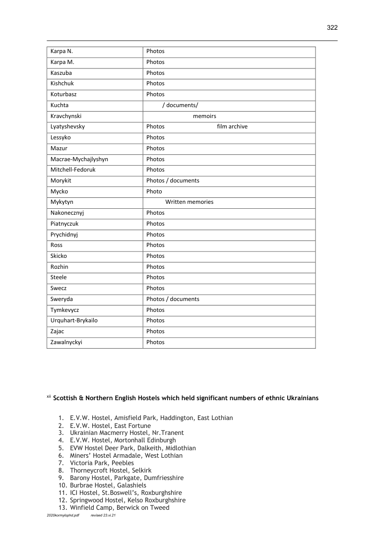
Victoria Park appears twice in Peter Kormylo’s work: on his map of Ukrainians in displaced persons and prisoner of war camps in Scotland between 1946 and 1951, and in his appendix of Scottish and northern English hostels that held significant numbers of ethnic Ukrainians. The map’s data is drawn from lists of camps held in the archives of the Association of Ukrainians in Great Britain and of the Ukrainian Catholic Church in Scotland.
Behind those lists is a priest’s notebook. Father Aleksandr Babij, an itinerant Ukrainian Greek Catholic priest who reached Scotland at the same time as the European Voluntary Workers, set out to identify and visit the camps scattered across the country, recording both the places and the names of residents who gave money towards buying a church building. Kormylo reconstructed his map from the original daybook.
Inclusion in that list carries a specific meaning. Kormylo writes that the camps and hostels it names are those where Ukrainians had registered themselves as formal branches of the Association of Ukrainians in Great Britain. Bound files of the newspaper Ukrainska Dumka carry short reports of daily life from these camps, although contributors often wrote anonymously or under pseudonyms because they feared forced repatriation. No such report has yet been traced for Peebles, so what the Victoria Park branch did is not known.
Victoria Park was not isolated. On Kormylo’s map it sits in a Border Counties group alongside Thorncroft Hostel at Selkirk, Burnbrae Hostel at Galashiels and Springwood Park Hostel at Kelso. Across Scotland, he puts the 1947 influx at almost two thousand Ukrainian displaced persons working alongside Lithuanians, Latvians and Estonians. That is a national figure and says nothing about how many people slept at Peebles.
The Border Counties group on Kormylo’s map
| Hostel or camp | County |
|---|---|
| Victoria Park Camp, Peebles | Peeblesshire |
| Thorncroft Hostel, Selkirk | Selkirkshire |
| Burnbrae Hostel, Galashiels | Selkirkshire |
| Springwood Park Hostel, Kelso | Roxburghshire |
After the huts
The huts were cleared after the war. By the 1988 aerial survey examined by RCAHMS, no trace of the camp was apparent. Cleland Avenue and Victoria Park Drive occupy parts of the former camp area, while the park itself returned to public use. In 1965 the council acquired additional land beside Springhill Road to strengthen access to the main park.
The park today
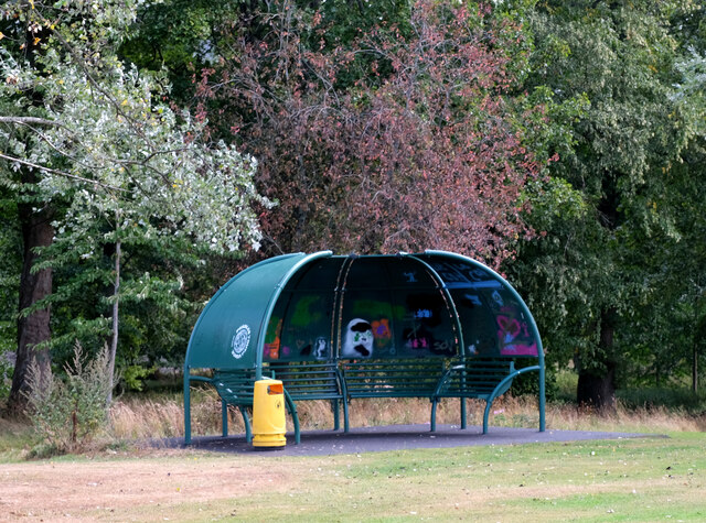
The surviving gates and railings were listed in 1995. Open grass, trees, paths and recreational facilities now define the park. Jim Barton’s 2025 photograph shows a modern curved shelter beside a path, part of the public landscape that followed the camp’s removal.
Sources
- Peter Kormylo, Ukrainians in Scotland (2021)
Undated
Printed 100, Figure 4-2, and printed 322, appendix xii, entry 7. Map and directory name Victoria Park, Peebles, among Ukrainian accommodation sites. The map’s 1946–51 range is regional, not exact operating dates for this camp.
- Historic Environment Scotland: Peebles, Victoria Park
Undated
NRHE 222941, NT23NE 62. RCAHMS archaeological notes, October 2002 and March 2006. Interpretation of RAF 106G UK 1319 frames 5245–7, 28 March 1946, and All Scotland Survey 1988; underlying aerial images not inspected.
- Scottish Borders Council: Peebles Common Good property
Undated
Victoria Park PB023/01; park land acquisitions and purposes. Public register read in full.
- Historic Environment Scotland: Victoria Park gates and railings
Undated
LB39268, listed 29 March 1995. Gatepiers dated 1887. Record calls the gift a Diamond Jubilee gift, which conflicts with its 1887 date; the anniversary wording is not repeated.
- Jim Barton: Stylish shelter in Victoria Park, Peebles
Undated
Original photograph taken 31 August 2025, NT 2544 4008, looking northeast from NT 2538 4002. CC BY-SA 2.0. Downloaded and visually inspected; present-day park, not a surviving camp hut.
- Peebles, Victoria Park: National Record of the Historic Environment 222941
Historic Environment Scotland · Archaeology note, October 2002
Read in full on 13 September 2026 at the canmore.org.uk address, because trove.scot refuses automated requests. Classification Military Camp (20th Century), site number NT23NE 62, NT 2550 3990, parish Peebles. Interpretation of RAF 106G UK 1319 frames 5245 to 5247, flown 28 March 1946. No operator, dates or occupants recorded; the photographs themselves are not inspected.
- Common Good Register, Peebles
Scottish Borders Council · Read 13 September 2026
Victoria Park PB023/01 at Kingsmeadows Road, with the 1888, 1914 and 1965 acquisitions and the common good dedication; Victoria Park Tennis Courts and Clubhouse PB021/03 at Springhill Road, ground acquired 1923 and augmented 1959. A property register: it does not mention the camp or its residents.
- Kormylo on Father Babij’s daybook and the AUGB branches
Peter David Kormylo, University of Glasgow · 2021
Full-text extraction read on 13 September 2026. Father Aleksandr Babij visited the Scottish camps and listed them with the names of donors; Kormylo built his map from the original daybook and states that the listed places are those where Ukrainians registered formal AUGB branches, with daily-life reports appearing in Ukrainska Dumka under pseudonyms. His camp totals differ between passages, 43 in one and 44 in another, and his figure of almost two thousand Ukrainian displaced persons in Scotland in 1947 is a national total, not a hostel figure.
- Victoria Park, Peebles: overview
Gazetteer for Scotland, School of GeoSciences, University of Edinburgh, and the Royal Scottish Geographical Society · 2025
Gazetteer entry read in full on the overview tab. It names the donor and the occasion of the gift, lists the later land acquisitions, and records the army’s wartime takeover of the park and the building of Nissen huts for troops.
Last researched 13 September 2026